
:: Clark Fork Idaho ::

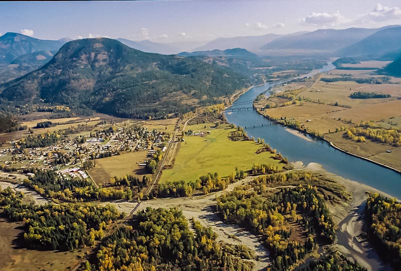
Looking east into Montana the town of Clark Fork lies on the left. In the background are the Cabinet range of the Rocky Mountains. The Clark Fork river empties into Lake Pend Oreille at the bottom of this photograph. The Cabinet Gorge dam is just upstream and supplies power to the area. Also upstream is the Cabinet Gorge fish hatchery. The land on the right side of this photograph is some of the areas most fertile farmland. Clark Fork is located approximately 25 miles east of Sandpoint, and is the first town you find after crossing into Idaho from Montana on Hwy 200.
Situated on the banks of the historic Clark Fork River, its origins date back to the late 1800's when the Northern Pacific Railway constructed a siding adjacent to the river. The Clark Fork River has beenThe City of Clark Fork Idaho on the Clark Fork River a source of commerce and recreation for decades. Clark Fork was named in honor of William Clark who along with Meriweather Lewis headed the expedition to the west in 1804. It is believed the Lewis and Clark party encountered the present day Clark Fork river near Missoula in October of 1805.
Today nestled in the shadows of the Cabinet Mountain Wilderness Area, Clark Fork still retains many vestiges of the old American West. Hunting and fishing opportunities abound in the Clark Fork valley. The Clark Fork River is a major spawning tributary used by Rainbow, Cutthroat, Mackinaw and the endangered Bull Trout to access pristine mountain streams to spawn.
Area: 627 acres | Elevation: 2,090′ | Population: 540 (2021) | High School Mascot: Wampus Cats
Search Clark Fork Real Estate | Meet a REALTOR | Request a Clark Fork Property
305 N First Ave, Sandpoint, ID 83864 | (208)255-2244 | toll free (800) 205-8771


Antelope Lake above Clark Fork to the left and The Green Monarchs on the right: These are some more photos of the Clark Fork area.

